-
ABOUT US
-
ACADEMICS
Curriculum Program
Departments
- English
- High School Chinese
- Primary and Junior School Chinese.
- High School Mathematics
- Middle School Mathematics
- Primary School Mathematics
- Music and Fine Arts
- Physical Education
- Physics
- Chemistry
- History and Geography
- Physical Science and Optional courses Department
- Middle School Biology
- High School Biology
- Social Sciences
- Computer Science
- Courses in Primary School
Achievements and Matriculations
College Counseling
Science & Technology Innovation Contest
Subject Competition
-
ARTS
-
ATHLETICS
-
AT SHSID
SHSID ∣ TIMES
PTSA
Club Exhibition
- 龙吟社
- Live 2 Drama
- Choir
- Hip-pop Dance Club
- The Primary School Dance Troupe
- Symposiums Club
- Biology Workshop
- You Shan
- VEX Robotic
- Peking Opera Club
- Baseball Club
- Model United Nations
- The World Scholar’s Cup
- Future Problem Solving Club
- United States Academic Pentathlon
- OM Club
- AMC Club
- Music for Patients
- SHSID Gazette
- Smile Charity
- Cultural Moments
- SciAcademy
- Stem Doge Alliance
- Chinese Debate Club
- IAA
- Mock Trial Club
- Zhengming Club
- Furry Friends
- GT-Racing
- Village Radio
- IMMC Club
- Creative Design and Intelligent Fabrication
- Future City Research Project
- ECOCAP
- AdvocaSEA
- SPDC
- Medishine
- Floorball Club
- Animusic MTC
- Wings Up
- All Booked
- Cyano
- Birding Community
Health and Wellness
Campus Safety
Cafeteria Service
-
ADMINISTRATION
-
ADMISSIONS
-
ALUMNI
Alumni Information
Honors Students
- Class of 2025
- Class of 2024
- Class of 2023
- Class of 2022
- Class of 2021
- Class of 2020
- Class of 2019
- Class of 2018
- Class of 2017
- Class of 2016
- Class of 2015
- Class of 2014
- Class of 2013
- Class of 2012
- Class of 2011
- Class of 2010
- Class of 2009
- Class of 2008
- Class of 2007
- Class of 2006
Who Studied at SHSID
SHS Foundation
-
DOCUMENTS
Grades 9-10: Job Shadow Day - Broaden Horizons and Map the World
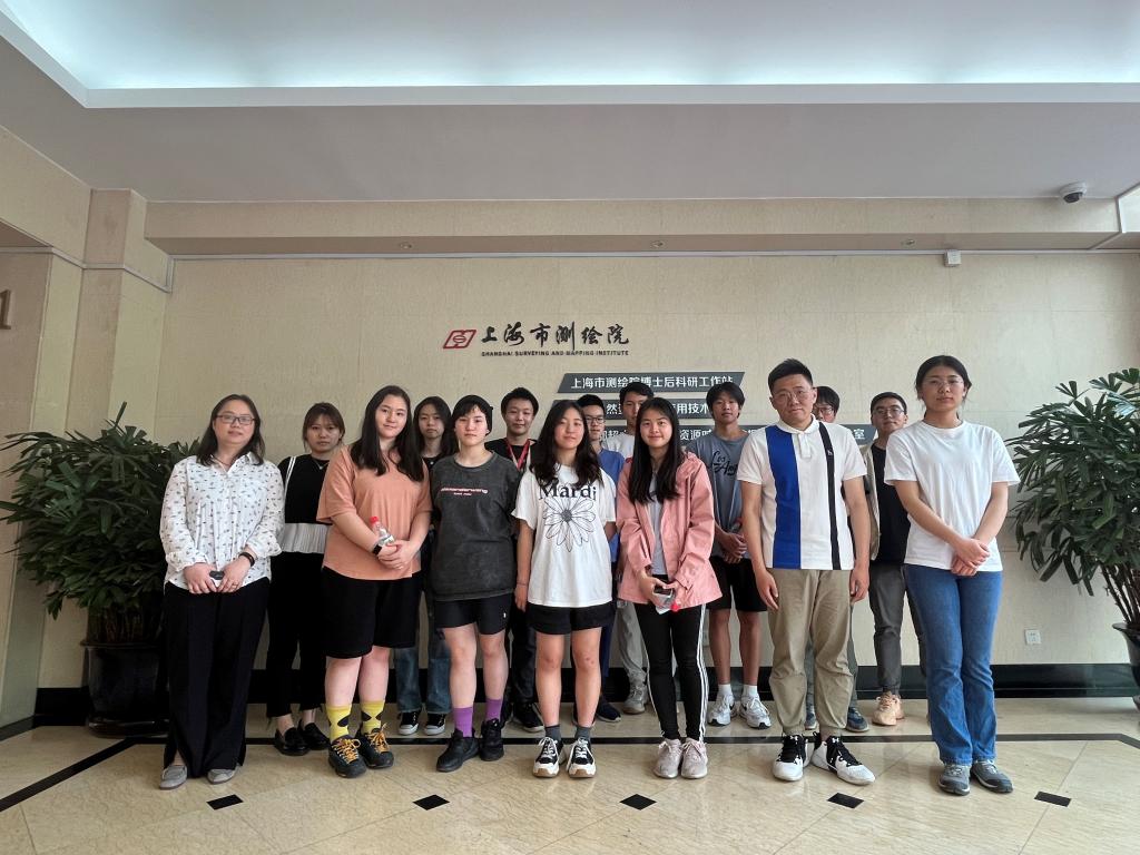
At the afternoon of May 19, the Job Shadow Day activity of 9th- and 10th-grades of Shanghai High School International Division was held at the Shanghai Institute of Surveying and Mapping. The activity was organized by the Teacher Advisor Office, largely supported by the institute. Professionals from various departments of the institute led the students to learn and experience the fascinating work of surveying and mapping. The activity was divided into three parts: visiting and learning about the history of the institute, attending a lecture on basic knowledge of surveying and mapping, and experiencing the work of surveying and mapping.
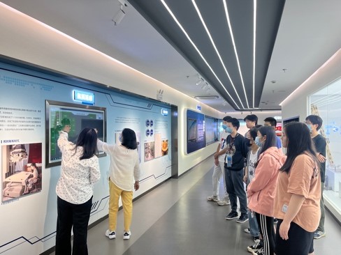
The seventy years of history of the institute and all the painstaking effort of the surveying and mapping workers are condensed in the Museum of History of the institute. The students were deeply moved by the devotional and inquisitive spirits of the workers. They also learned that the major elements of the city, including the metro transit, river-crossing tunnels, Maglev train, and underground pipe system, could not have been constructed without the work of surveying and mapping.
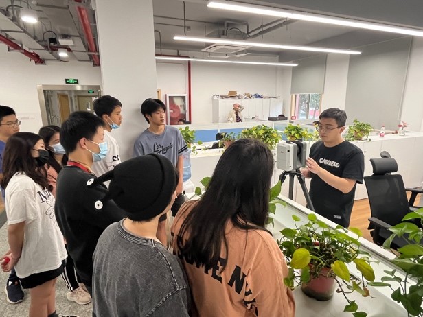
The lecture on surveying and mapping was lively and the students actively interacted with the lecturer. The lecturer answered questions including “What is surveying and mapping?”, “What is the purpose of surveying and mapping?”, and “What are the underground pipe lines?”
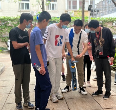
Lastly, the students learned and experienced two instruments commonly used in the daily work of surveying and mapping: metallic pipeline detectors and laser scanning radars. The metallic pipeline detector is used to locate the underground pipelines and generate 3-dimensional images of the interior and exterior of structures above ground. The instructor carefully explained and demonstrated the usage method of the detector. Under the directions of the instructor, the students operated the detector themselves to detect the pipelines. The instructor also used the laser scanning radar to demonstrate how the 3-dimensional image of the interior of a building is generated and introduced the concept and principle of spatial point clouds to the students. The students viewed a 3-dimensional map of Shanghai using the software database, which included detailed and accurate street views and information about the underground pipelines. They also operated computers themselves and explored the diorama of the constructions above ground and of underground pipelines in the Lingang area in the database.
This activity allowed the students to encounter professional surveying and mapping knowledge that school textbooks do not contain, as well as experience the daily work of surveying and mapping. Especially during the experiencing part at the end, the students were full of curiosity about the usages and working principles of the various instruments and software. They presented great interest during the activity and displayed great fervor to surveying and mapping.
“I gained a lot of knowledge in this activity. Thanks to the school for providing a chance to be more deeply acquainted with the unseen yet hardworking workers of surveying and mapping. They allow us to have the access to navigation and maps, and to go wherever we want easily and accurately.”
-9(5) Joshua
“The teachers showed us how they use DNNS technology to collect data and reflect on Shanghai's development. We then listened to a short lecture about underground water/gas/electricity pipes. We also got to try using the actual detection machine ourselves and saw the actual model of Shanghai pipes. It allowed me to realize how important accurate mapping is. I'm glad I visited the institute! It was a unique and educational experience that I'll never forget.”
-9(3) Jennifer
(Written/Pictures by Ma Yanbo form TA office, 9(8) Alex Dong Reviewed by Qian Zuo)